AquiferWatch: Groundwater Storage of the Wairau Plain Aquifer
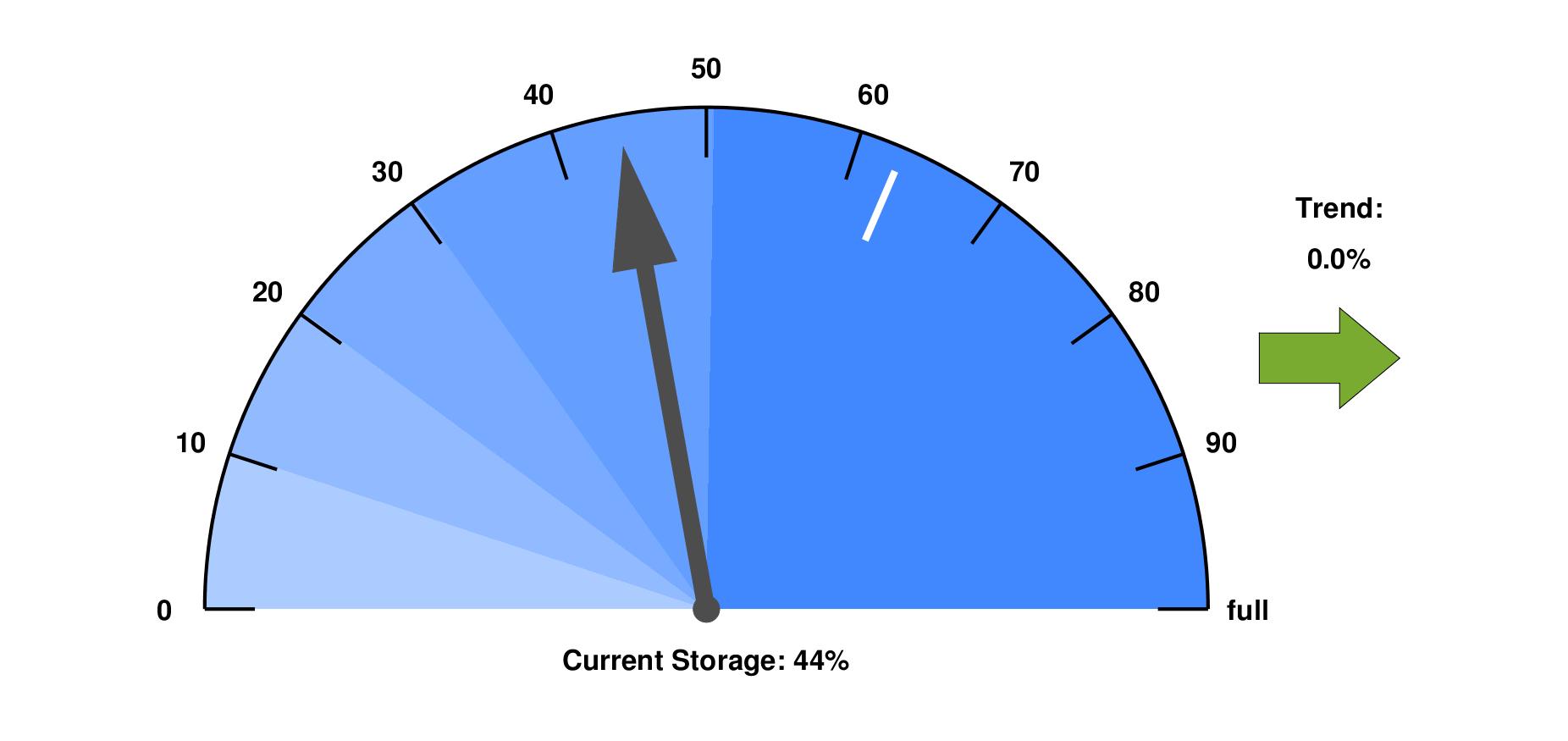
AquiferWatch shows the current state of the Wairau Aquifer. It is based on observed groundwater levels and results of the Wairau Plains Goundwater Model (WPM) developed at TU Dresden. The white dash shows today's mean historic level. See methods for further information on the modelling approach.
Wairau Aquifer Storage
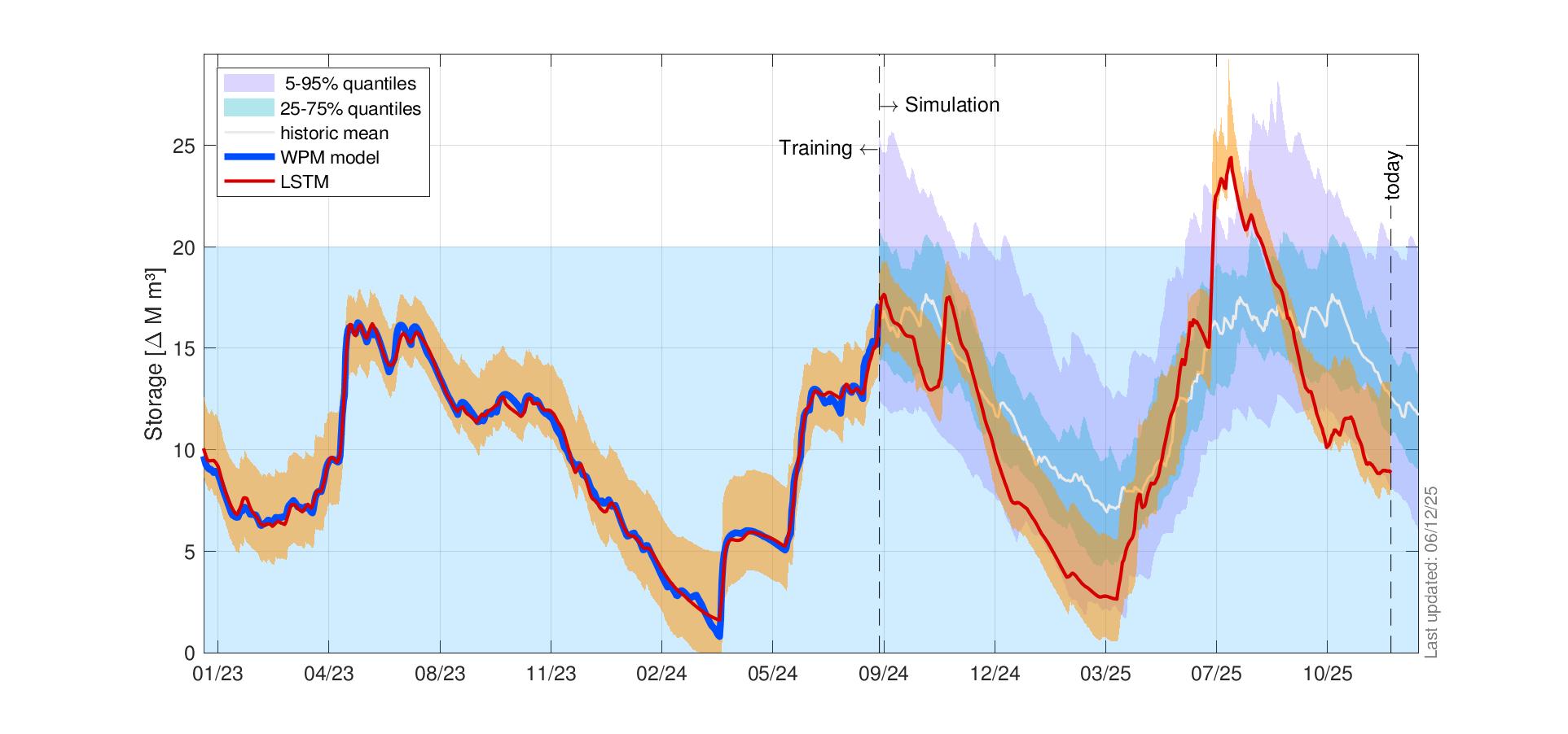
Aquifer storage gets recharged mainly by the Wairau River and to some degree also by local rainfall, the Waihopai River and minor groundwater inflows from the southern and northern valleys. The major discharges are springs and drains, river-return flows, offshore groundwater discharge and groundwater abstractions.
The figure below shows simulated sustainable Wairau Aquifer storage (red) and its uncertainty range (orange band) together with the average of historical storage levels (white) and historical storage quantiles (shaded areas). This allows to compare current aquifer storage with historical levels for any given day of the year.
AquiferWatch is a joint research effort between the Marlborough District Council, Lincoln Agritech Ltd, and the Technische Universität Dresden, Germany. It was funded by the MDC, under the MBIE Envirolink Scheme and with co-funding from TU Dresden.